You know, technology is really changing the game for farmers these days. One of the coolest tools in this new wave is Agriculture UAVs—those are basically drones that fly over the fields. And, get this: according to a report from MarketsandMarkets, the global market for these farming drones is expected to hit around $4.8 billion by 2025. That’s a huge jump from 2020, with growth rates of over 30% annually! It shows just how much farmers are leaning on precision farming techniques these days—using data to make smarter decisions and get better yields.
These drones are pretty amazing. They let farmers check on crop health, see if they need to water more or less, and even spot pest problems early on. With cool tech like multispectral and thermal cameras on board, they can gather all sorts of vital info quickly, helping farmers act fast and boost productivity. In fact, a study by the American Society of Agronomy found that using UAVs can increase crop yields by as much as 15%. That’s pretty significant and really shows how much these tech tools can impact farming.
Plus, with climate change and a growing world population putting pressure on food supplies, agriculture drones are becoming an essential part of a farmer’s toolkit. By embracing these high-tech solutions, farmers can make better informed decisions, use resources more efficiently, and help secure the future of food production—even as things get more competitive and challenging out there.

Overview of Agriculture UAVs and Their Role in Modern Farming
Agriculture UAVs, or drones, have significantly transformed modern farming practices by enabling precise crop management and enhancing yield optimization. These cutting-edge tools facilitate real-time monitoring of agricultural fields, providing farmers with vital data that can lead to better decision-making. According to a report by MarketsandMarkets, the agricultural drone market is projected to grow from approximately $1.2 billion in 2021 to $4.0 billion by 2026, indicating an increasing reliance on aerial technologies in agriculture.
The role of UAVs in modern farming encompasses various applications, including crop health monitoring, irrigation management, and soil analysis. Drones equipped with multispectral and thermal imaging cameras can capture detailed images of crops, allowing farmers to assess vegetation health and identify areas suffering from diseases or pests. A study by the American Society of Agricultural and Biological Engineers (ASABE) indicates that using UAVs for crop monitoring can improve yield by up to 15% due to timely interventions. Furthermore, these drones can optimize resource usage, reducing water and fertilizer waste by providing precise application data.
As the agricultural industry continues to embrace technological advancements, the integration of UAVs into everyday farming practices is becoming essential. Farmers who leverage this technology are not only able to improve efficiency but also contribute to sustainable farming efforts by minimizing environmental impact. The data-driven insights provided by agricultural UAVs are key to addressing the challenges of food production in a world facing increasing population pressures and changing climatic conditions.
Types of Agriculture UAVs and Their Specific Applications in Crop Management
Agricultural Unmanned Aerial Vehicles (UAVs) have revolutionized the way farmers approach crop management and yield optimization. There are various types of UAVs tailored for specific applications, enhancing precision agriculture significantly.
Fixed-wing UAVs, for instance, are renowned for their ability to cover expansive fields quickly and efficiently, making them ideal for large-scale crop monitoring. According to a report by Research and Markets, the agricultural drone market is expected to reach $6.5 billion by 2025, indicating a growing recognition of their applications in crop health assessment and field analysis.
Multirotor drones, on the other hand, excel in vertical take-off and landing, making them suitable for detailed inspections and monitoring of specific crop sections. These UAVs are effective for tasks such as pest detection and irrigation management, as they can hover over target areas for closer observation. A study published in the Journal of Agricultural Science found that UAV-based imaging can improve the detection of plant stress signs by up to 80%, enabling timely interventions that can lead to yield improvements. Furthermore, hybrid models that combine both fixed-wing and multirotor capabilities are emerging, providing a comprehensive solution that caters to various agricultural needs, from aerial seeding to crop spraying, demonstrating the versatility and value of UAV technology in modern agriculture.
Data Collection Capabilities of UAVs for Precision Agriculture Strategies
The integration of Unmanned Aerial Vehicles (UAVs) in agriculture has revolutionized the way farmers manage their crops and optimize yields. UAVs are equipped with advanced sensors and cameras that enable precise data collection, which is essential for informed decision-making in precision agriculture strategies. These flying devices can gather vital information on crop health, soil conditions, and water usage, allowing farmers to monitor their fields from a bird's-eye view with unparalleled accuracy.
Tips for effective data collection using UAVs include planning flight paths carefully to cover the entire area of interest and scheduling flights during optimal lighting conditions for clearer imagery. Regular calibration of sensors is crucial to ensure data quality; maintaining your UAV and ensuring it's in good working order can prevent potential data loss. Additionally, leveraging software for data analysis can help interpret the collected information, transforming it into actionable insights for better resource allocation.
By harnessing the data collection capabilities of UAVs, farmers can identify issues such as pest infestations or nutrient deficiencies early, enabling timely interventions. This proactive approach not only enhances crop management but also leads to increased yield optimization, turning analytical insights into practical outcomes that benefit both the land and the farmer’s bottom line.
Utilizing UAVs for Crop Monitoring: Health Assessment and Yield Prediction
Utilizing UAVs for Crop Monitoring: Health Assessment and Yield Prediction
The integration of Unmanned Aerial Vehicles (UAVs) in agriculture has revolutionized crop monitoring, enabling farmers to conduct health assessments and predict yields more accurately. According to a report by the National Agricultural Aviation Association, employing UAV technology can enhance crop monitoring efficiency by up to 80%. These aircraft are equipped with multispectral cameras that capture high-resolution images, allowing for the evaluation of crop health based on variables such as chlorophyll levels and moisture content. This data is essential in diagnosing issues such as nutrient deficiencies or pest damage early in the growing season, thereby enabling timely interventions.
In addition, leveraging UAVs for yield prediction has shown significant promise. Research conducted by the University of California indicates that UAV data can improve yield prediction accuracy by approximately 12%, when compared to traditional ground-based assessment methods. This improvement is made possible through detailed aerial mapping and the analysis of crop growth patterns over time. By providing actionable insights, UAV technology allows farmers to make informed decisions regarding resource allocation, ultimately leading to optimized yields and increased profitability. The ability to analyze vast areas quickly and efficiently marks a significant advancement in agricultural practices, fostering sustainable farming and effective resource management.
How to Use Agriculture UAVs for Improved Crop Management and Yield Optimization
| Crop Type |
Monitoring Technique |
Health Assessment Index |
Yield Prediction (%) |
UAV Model |
| Maize |
Multispectral Imaging |
NDVI (Normalized Difference Vegetation Index) |
85 |
Phantom 4 RTK |
| Wheat |
RGB Imaging |
VWC (Vegetation Water Content) |
90 |
Mavic 3 Enterprise |
| Soybean |
Thermal Imaging |
Canopy Temperature |
75 |
Inspire 2 |
| Rice |
Hyperspectral Imaging |
Chlorophyll Content |
80 |
WingtraOne |
| Potatoes |
LiDAR Scanning |
Plant Density |
70 |
Parrot Bluegrass |
Integrating UAV Data with GIS for Enhanced Decision-Making in Farming
The integration of UAV data with Geographic Information Systems (GIS) has revolutionized the decision-making processes in modern agriculture. Utilizing UAVs for data collection allows farmers to capture high-resolution images and gather real-time information about their fields. According to a report by the Precision Agriculture Association, farms employing UAV technology have witnessed an increase in crop yields by up to 15%. This significant impact is largely due to the ability of UAVs to perform detailed analysis, such as identifying crop health, moisture levels, and nutrient deficiencies.
GIS plays a crucial role in interpreting the data collected by UAVs. By overlaying UAV imagery with GIS layers, farmers can visualize spatial patterns and make more informed decisions regarding crop management. For instance, a study published in the Journal of Agricultural Informatics found that integrating UAV-derived data with GIS systems enables precise applications of fertilizers and pesticides, ensuring they are used more efficiently. This combination not only enhances productivity but also promotes sustainable farming practices, reducing the environmental impact of agriculture. As the agricultural sector continues to adopt these technologies, the synergy between UAVs and GIS is poised to transform the landscape of crop management and optimization strategies.
Impact of UAV Technology on Sustainable Agricultural Practices
The integration of UAV technology in agriculture is revolutionizing sustainable farming practices by enhancing precision and efficiency in crop management. Drones equipped with advanced sensors and imaging capabilities allow farmers to monitor their fields in real-time. This enables the early detection of issues such as pest infestations, nutrient deficiencies, and water stress, which in turn facilitates timely interventions. By employing UAVs for data collection, farmers can adopt a more informed approach to crop management, ensuring that resources are allocated effectively and minimizing waste.
Moreover, UAVs contribute significantly to yield optimization by enabling variable rate application of inputs like fertilizers and pesticides. Through precise mapping and analysis of field conditions, farmers can tailor their application strategies to meet the specific needs of different zones within a field. This targeted approach not only increases productivity but also reduces the environmental impact associated with over-application of chemicals. As a result, UAV technology supports sustainable agricultural practices by promoting resource conservation, lowering costs, and fostering an ecosystem that balances agricultural productivity with environmental stewardship.
Case Studies: Successful UAV Implementations in Crop Yield Optimization
In recent years, the integration of Agriculture Unmanned Aerial Vehicles (UAVs) into crop management systems has gained momentum, demonstrating significant advantages in yield optimization. Notably, a study published by the American Society of Agronomy indicated that UAVs can improve crop monitoring efficiency by up to 80%, facilitating timely interventions based on accurate aerial data. This technology allows farmers to analyze crop health and resource distribution effectively through multispectral imaging, leading to enhanced decision-making processes.
For instance, in California, several farms have successfully implemented UAVs to assess irrigation patterns and identify nutrient deficiencies. According to a report by the USDA, one farm reported a 15% increase in yield after utilizing UAV data for precise fertilizer application. Additionally, a case study highlighted on a leading agricultural technology platform illustrated how a vineyard in France leveraged UAV mapping to optimize pruning strategies, resulting in a 20% reduction in labor costs while simultaneously boosting grape quality and quantity.
These case studies underscore the transformative potential of UAVs in agriculture. By providing real-time insights and actionable data, farmers can make informed decisions that not only enhance crop yields but also promote sustainable farming practices. As the technology continues to evolve, its applications are set to redefine traditional agricultural methodologies, offering promising prospects for future harvests.
Crop Yield Optimization Using UAV Technology
FAQS
Vs in precision agriculture?
Farmers can maximize effectiveness by carefully planning flight paths, scheduling flights during optimal lighting conditions, regularly calibrating sensors, and maintaining the UAV in good working order.
UAVs equipped with multispectral cameras capture high-resolution images that help evaluate crop health by measuring factors like chlorophyll levels and moisture content, enabling early diagnosis of issues like nutrient deficiencies or pest damage.
Research shows that UAVs can improve yield prediction accuracy by about 12% compared to traditional assessment methods through detailed aerial mapping and analysis of crop growth patterns over time.
UAV data offers actionable insights that assist farmers in making informed decisions regarding resource allocation, leading to optimized yields and increased profitability.
Regular calibration of sensors is crucial to ensure data quality and prevent potential data loss, enabling accurate collection of vital agricultural information.
By allowing for efficient monitoring and management practices, UAVs foster sustainable farming by enhancing crop management and optimizing resource utilization, ultimately benefiting both the land and farmers’ profits.
UAVs can help identify issues such as pest infestations and nutrient deficiencies early in the growing season, enabling timely interventions to mitigate potential crop damage.
Leveraging data analysis software is important for interpreting collected UAV data, transforming it into actionable insights that enhance crop management and resource allocation.
UAVs mark a significant advancement in agricultural practices by providing quick and efficient analysis of vast areas, thereby fostering effective resource management and improving agricultural outcomes.
Conclusion
Agriculture UAVs have become a pivotal technology in modern farming, revolutionizing crop management and yield optimization. These unmanned aerial vehicles come in various types, each designed for specific applications ranging from data collection to health assessments. Their robust data collection capabilities enable farmers to implement precision agriculture strategies effectively, leading to improved monitoring of crop conditions and accurate yield predictions.
By integrating the data collected by Agriculture UAVs with Geographic Information Systems (GIS), farmers can make informed decisions that enhance their overall farming practices. This technology not only boosts crop yields but also fosters sustainable agricultural practices, ensuring a balance between productivity and environmental stewardship. Various case studies highlight the successful implementations of Agriculture UAVs, demonstrating their significant impact on optimizing crop yields and advancing modern agricultural techniques.
 GDU
GDU
 DJI
DJI MMC
MMC GDU
GDU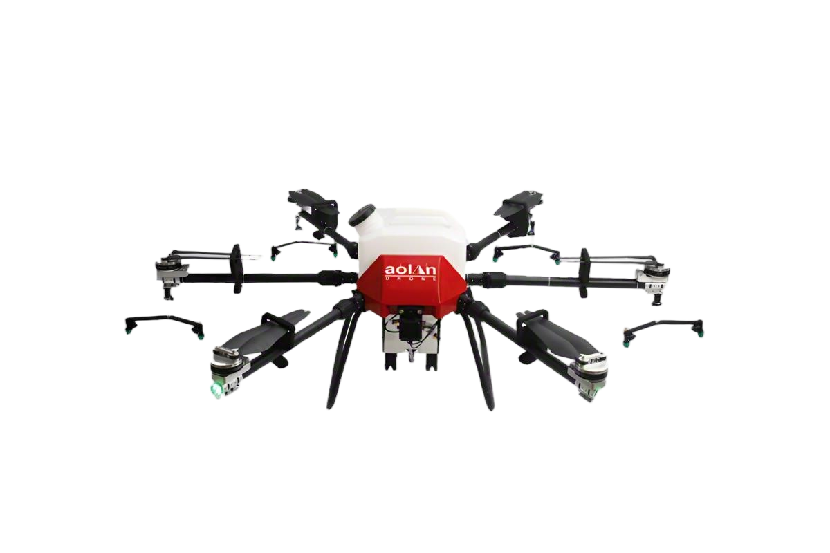 AOLAN
AOLAN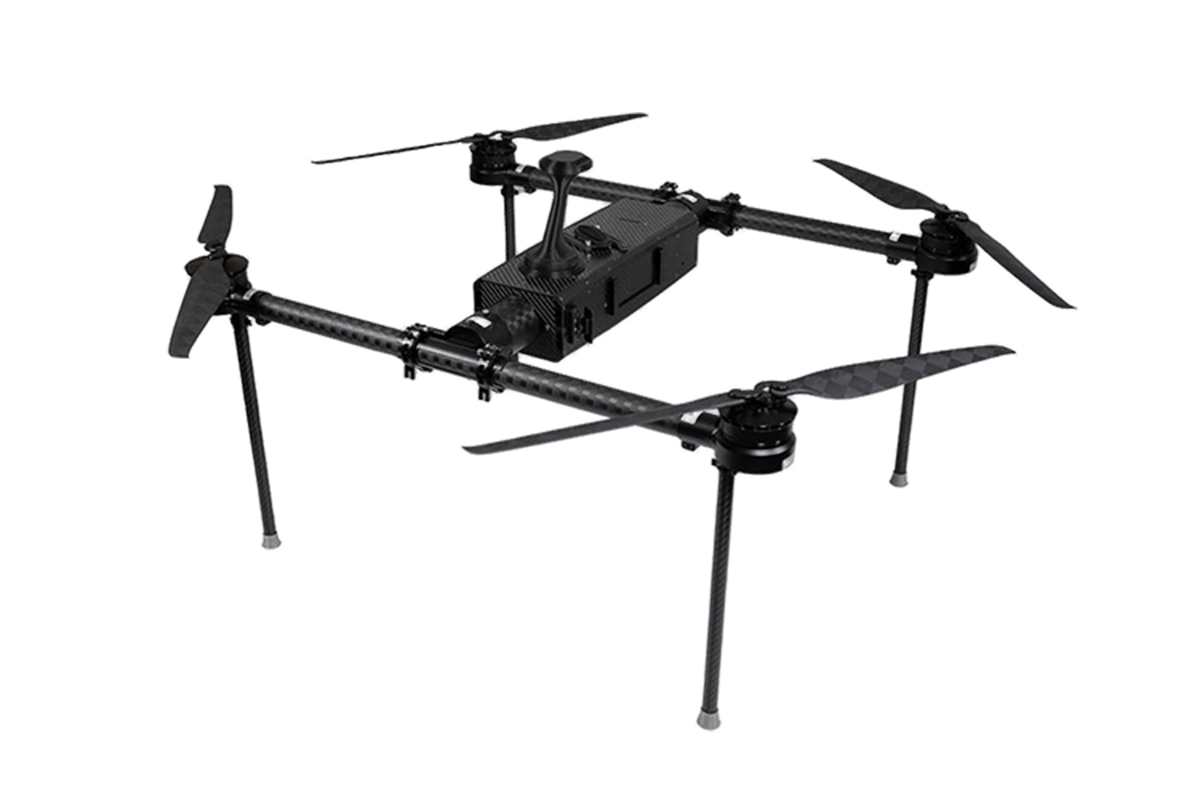 KEEL
KEEL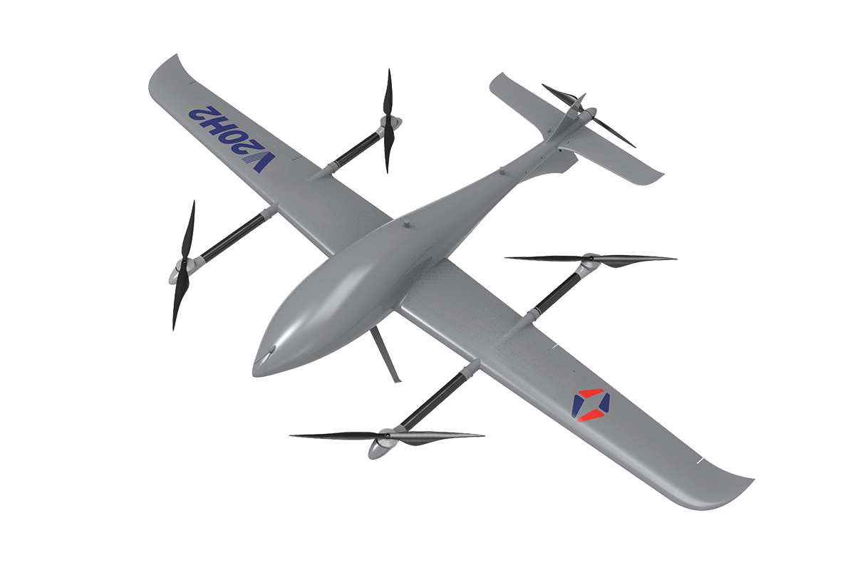 SKY NEXT


